


đủ loại kem đặc biệt của vùng này


đàn ngỗng trời đẹp quá, thanh thản chẳng bị xô đuổi...


Phong cảnh hữu tình


Ngũ Long Công Chúa bên 'song'


Chùm Cherry thấy mê


***************************
Okanagan
From Wikipedia, the free encyclopedia
This article is about the region in British Columbia. For the extended cross-border region inclusive of Washington state, see Okanagan Country. For other uses, seeOkanogan.
| This article needs additional citations for verification. (December 2012) (Learn how and when to remove this template message) |

The Okanagan (/oʊkəˈnɑːɡən/ ohk-ə-nah-gən), also known as the Okanagan Valley and sometimes as the Okanagan Country, is aregion in the Canadian province of British Columbia defined by the basin of Okanagan Lake and the Canadian portion of the Okanagan River. It is part of the Okanagan Country, extending into the United States as Okanogan Country. As of 2011, the region's population is approximately 341,818. The primary city is Kelowna. The region is known for its dry, sunny climate, dry landscapes and lakeshore communities and particular lifestyle.[1] The economy is retirement and commercial-recreation based, with outdoor activities such as boating and watersports, snow skiing and hiking. Agriculture has been focused primarily on fruit orchards, with a recent shift in focus tovineyards and wine. The region stretches northwards via the Spallumcheen Valley to connect to Sicamous in the Shuswap Country, and reaches south of the Canada–United States border, where it continues as Okanogan County. The Okanagan as a region is sometimes described as including the Boundary, Similkameen and Shuswap regions, though this is because of proximity and historic and commercial ties with those areas.
Contents
[hide]Name origin[edit]
The name derives from the Okanagan language place name ukʷnaqín.[2] An alternate explanation from Washington proposes "People living where you can see the top", ostensibly of Chopaka Peak in the Lower Similkameen.[3]
History[edit]
The Okanagan Valley is home to the Syilx, commonly known as the Okanagan people, an Interior Salish people who live in the valley from the head of Okanagan Lakedownstream to near the river's confluence with the Columbia River in present-day Washington, as well as in the neighbouring Similkameen Valley and the Upper Nicola to the north of that, though the whole of their traditional territory encompasses the entire Columbia River watershed and includes areas east of the Okanogan River in Washington, i.e. the Colville Reservation. At the height of Okanagan culture, about 3000 years ago, it is estimated that 12,000 people lived in this valley and surrounding areas. The Okanagan people employed an adaptive strategy, moving within traditional areas throughout the year to fish, hunt, or collect food, while in the winter months, they lived in semi-permanentvillages of kekulis, a type of pithouse.[4] Today the member bands of the Okanagan Nation Alliance are sovereign nations, with vibrant natural resource and tourism based economies. Their annual August gathering near Vernon is a celebration of the continuance of Syilx life and culture.
In 1811 the first non-natives came to the Okanagan Valley, in the form of a fur trading expedition voyaging north out of Fort Okanogan, a Pacific Fur Company outpost at the confluence of the Okanogan and Columbia Rivers. Within fifteen years, fur traders established, known as the Brigade Trail via the Cariboo Plateau and Thompson Country to Fort Kamloops and through the Okanagan, from Fort Alexandria at the southern end of the New Caledonia fur district in the Central Interior to the north, to Fort Vancouver, the HBC's headquarters in the Columbia Department, for passing furs between New Caledonia and the Columbia River for shipment to the Pacific. The trade route lasted until 1846, when the Oregon Treaty laid down the border between British North America and the United States west of the Rocky Mountains on the 49th parallel. The new border cut across the valley, bisecting Osoyoos Lake. To avoid paying tariffs, British traders forged a newer route that bypassed Fort Okanogan via the Fraser Canyon from Spuzzum up over theCascade Mountains, then via the Nicola, Coldwater and Fraser rivers to Fort Langley instead of to Fort Vancouver, which had come into being in American territory. The Okanagan Valley did not see many more outsiders for a decade afterward.

In 1859, the first European settlement was established when Father Charles Pandosy led the making of an Oblate mission atOkanagan Mission, now a neighbourhood of Kelowna. The Fraser Canyon Gold Rush of 1858 eventually encouraged more settlement as some prospectors from the United States took the Okanagan Trail route on their way to the Fraser Canyon, although at the height of the rush the American adventurers who used the route did not settle because of outright hostilities from the Syilx, whom a few of the parties traversing the trail had harassed and brutalized. A few staked claims around the South Okanagan and Similkameen valleys and found gold and copper in places, with another trail from Fort Hope to newer goldfields at Rock Creek andWild Horse Creek in the East Kootenay, skirting the US border and crossing Osoyoos Lake at Osoyoos, which was a customs post and also the location of the gold commissioner's office. The Dewdney Trail, surveyed and built by Edgar Dewdney, was constructed to prevent trade in the region from going north-south instead of remaining firmly under British control, and also for military mobility purposes should the need arise. In the decades following the gold rushes, ranchers, mostly on military land grants, came to settle on Okanagan Lake; notable ones included the Coldstream Ranch near Vernon, the Ellis Ranch, which formed the basis of the City of Penticton once subdivided, and the Richter Ranch, which continues in operation today, in the mountains between the Town of Oliver and the Village of Keremeos in the Similkameen.
A mining industry began in the southern Okanagan region, with Fairview, now an empty benchland on the western side of Oliver, the best-known and largest of the boomtowns created in the later part of the 19th Century. More farmers, as well as a small service industry, came to meet the needs of the miners.
Fruit production is a hallmark of the Okanagan Valley today, but the industry began with difficulty. Commercial orcharding of apples was first tried there in 1892, but a series of setbacks prevented the major success of commercial fruit crops until the 1920s.
.jpg)
Until the 1930s, the demand for shipping fruit and other goods did drive a need for ongoing operations of the sternwheeler steamboatsthat serviced Okanagan Lake, operated by a subsidiary of the Canadian Pacific Railway, linking the Southern Mainline with the original transcontinental mainline at Sicamous: the SS Aberdeen from 1886 and then the SS Sicamous and SS Naramata from 1914, and others. The Sicamous and Naramata survive as a tourist attraction on Okanagan Beach on the north side of Penticton, the Sicamous serving both as a museum and also an event facility. Other steamboats operated on Skaha Lake to the south of that city. The club lounge and wheelhouse, without any keel or hull, of the SS Okanagan are in the same park as the Sicamous and Naramata.
While the last half-century has grown several resource-based enterprises in the region, primarily forestry, though mining had played an important role in earlier times. The fastest-growing industries in the Okanagan today are real estate, tourism accommodations and services, and retirement-driven real estate development as well as the ripping up of orchards and their replacement by wineries and vinyards.[citation needed] Favoured by its sunny climate, lakes, and winery attractions, the valley has become a popular destination for vacationers and retirees. The area also attracts seasonal fruit-picking labourers, primarily from Quebec and Mexico.[5][6]
Climate[edit]
Like much of Southern British Columbia, the Okanagan receives a mild climate, although the Okanagan is considerably drier than many other areas. It is located roughly between the temperate rainforests of coastal British Columbia, and the world's only temperate forest inland, on the western slopes of the Columbia mountains. Most of the Okanagan lies within the rain shadow of the Cascade Mountains to the southwest. Areas in the north end of the valley receive more precipitation and cooler temperatures than areas to the south. Generally, Kelowna is the transition zone between the drier south and the wetter north. Vegetation also ranges from cactus and sagebrush in the south, to Cedar and Hemlock trees in the North. The Okanagan Valley receives hot summers and moderately cold winters, although the latter are extremely mild by Canadian standards; south of and including the city of Kelowna, no month of the year has an average high temperature that is below freezing (0°C). Areas near Osoyoos and Oliver claim to be Canada's only desert, though they are really shrub-steppe and only semi-arid, and other parts of BC have similar climates and vegetation. Daytime highs in that region occasionally surpass 40 °C in the summer months.
Between 2000BC and 1900AD, the climate and vegetation of the Okanagan had changed little. However, historical records from the Pacific Agrifood Research Station inSummerland indicate that the Okanagan climate had warmed by about 1°C between 1908 and 1994.[7]
Sport[edit]
Ice hockey is a popular sport in the region with WHL team Kelowna Rockets playing in the region's most populated city. The Jr. A teams are the Vernon Vipers, Westside Warriorsand the Penticton Vees of the BCHL. Penticton were the 2012 national Jr. A champions, after they ousted the Woodstock Slammers for the title. Jr. B sides Kelowna Chiefs,Summerland Steam, Osoyoos Coyotes and North Okanagan Knights play in the KIJHL, Osoyoos having won the 2010/11 KIJHL season. Penticton and Summerland are both home to Chicago Blackhawks Defenceman Duncan Keith.
The area has been host to multiple junior hockey championships, including the Memorial Cup in Kelowna in 2004 and RBC Cup in Vernon in 1990 (then called the Centennial Cup) and 2014.
Kelowna is home to junior Canadian football team Okanagan Sun, and Jr. Baseball team Kelowna Falcons, including the UBC Okanagan Heat university program.
Agricultural Labour[edit]
The continued growth and operation of the agricultural industry in the Okanagan absolutely depends on the employment of temporary migrant workers.[12]
In 2009, there were 3,000 Mexican migrant labourers working in the Okanagan.[12]
See Racialization, Seasonal Agricultural Workers Program and Racialization of Labour in the Okanagan.
See also[edit]
**********************************************************
Osoyoos
From Wikipedia, the free encyclopedia
| Osoyoos | |
|---|---|
| Town | |
| Town of Osoyoos[1] | |

Town of Osoyoos
| |
| Motto: Canada's warmest welcome[2] | |

Osoyoos
| |
| Coordinates: 49°01′56″N 119°28′05″W | |
| Country | |
| Province | |
| Region | South Okanagan/Boundary |
| Regional District | Okanagan-Similkameen |
| Incorporated | January 14, 1946 |
| Government | |
| • Mayor | Sue McKortoff |
| • Governing Body | Osoyoos Town Council |
| • MP | Richard Cannings |
| • MLA | Linda Larson |
| Area | |
| • Town | 8.76 km2 (3.38 sq mi) |
| Elevation | 283 m (928 ft) |
| Population (2011) | |
| • Town | 4,845 |
| • Density | 553.1/km2 (1,433/sq mi) |
| • Urban | 4,855[3] |
| Time zone | Pacific Time Zone (UTC-8) |
| • Summer (DST) | Pacific Daylight Time (UTC-7) |
| Postal code span | V0H |
| Area code(s) | 250 / 778 / 236 |
| Highways | |
| Website | www |

Osoyoos (/ɒˈsuːjuːs/ o-soo-ews,[2] historically /ˈsuːjuːs/ soo-ews)[4] is the southern-most town in the Okanagan Valley in British Columbia between Penticton and Omak. Near the border with Washington state, the town is also adjacent to the Indian Reserveof the Osoyoos Indian Band.[4] The origin of the name Osoyoos was the word sẁiẁs (pronounced "soo-yoos") meaning "narrowing of the waters" in the local Okanagan language (Syilx'tsn). The "O-" prefix is not indigenous in origin and was attached by settler-promoters wanting to harmonize the name with other O-names in the Okanagan Country (Oliver, Omak, Oroville, Okanogan). There is one local newspaper, the Osoyoos Times.
The town’s population of 4,845[5] swells in the summer months with visitors from elsewhere in British Columbia and neighboringAlberta, as well as elsewhere in Canada. Also, a newer contingent of international visitors[citation needed] is supported by proximity to the Kelowna and Penticton Airports. A growing year-round retiree population is evidenced by the predominance in the population of people over 50 years old[6] and with the recent boom of condominium and suburban development (though somewhat thwarted by the 2008–09 economic downturn). Another 1,892 people surround the town within the "Okanagan-Similkameen A" area.[6]
Contents
[hide]History[edit]
Aboriginal people have lived in the Osoyoos area for thousands of years, as evidenced by rock and an oral tradition explaining their history before Europeans arrived to the valley in 1811.
The first Europeans to Osoyoos were fur traders working for the Pacific Fur Company, an American enterprise. They ventured up the Okanagan River to Osoyoos Lake and farther north. After the Hudson’s Bay Company took over the fur trade in 1821, theOkanagan Valley became a major trade route for supplies to inland forts of British Columbia and furs that were shipped south to the Columbia River and the Pacific to European and Asian markets. The final Hudson’s Bay Company brigade in 1860 was the end of an era, as gold rushes transformed the economy of the new Colony of British Columbia. As parties of miners headed for the Fraser goldfields via the Okanagan Trail, they commonly met conflict with the Okanagan people.[7] [8][9] The Dewdney Trailpassed through Osoyoos on its way from Hope to the Kootenays. The Dewdney Trail now forms the backbone of the Crowsnest Highway.
Thousands of miners heading to the goldfields and drovers with large herds of livestock crossed the 49th parallel after 1858. A custom house was built in Osoyoos in 1861 with John Carmichael Haynes as the tax collector.[10][11] Haynes was also the first pioneer settler who obtained land along the Okanagan River north of Osoyoos that had been part of the Osoyoos Indian Reserve established by the Joint Indian Reserve Commission in 1877. These lands, now known as the Haynes Lease lands, can still be visited today and are home to an original barn.
Osoyoos was incorporated as a village in 1946 when the railway arrived and became a town in the 1980s. The railway was discontinued, and its stationhouse and grounds now serve as the Osoyoos Sailing Club.
Location, geography and ecology[edit]
Osoyoos is situated on the east-west Crowsnest Highway (Highway 3) with a significant ascent out of the Okanagan Valley in either direction. The Crowsnest headed east begins with an 18 km (11 mi) switchback up the flank of the Okanagan Highland with a 685 m (2,247 ft) rise to the mining and ranching region of Anarchist Mountain, which is part of the Boundary Country (the stretch of rising highway is also referred to as Anarchist Mountain). Highway 3 westbound leads to Keremeos and the Similkameen Valleyvia Richter Pass. On Highway 97 south is a 24-hour border crossing between Canada and the United States between Osoyoos and Oroville, Washington. The border crossing is located 4 km (2.5 mi) south of the Highway 3 and 97 intersection on the northwest side of town.
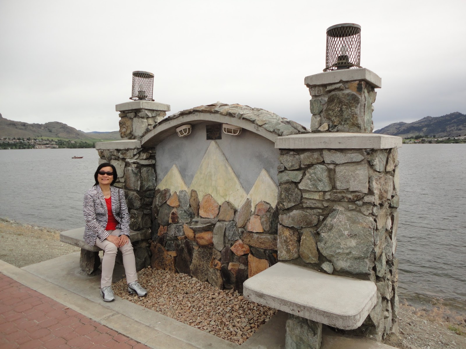
The town is situated on Osoyoos Lake, which has a perimeter of 47.9 km (29.8 mi), an elevation of 276 m (906 ft), a maximum depth of 63 m (207 ft), and a mean depth of 14 m (46 ft). The lake’s elevation marks the lowest point in Canada of the Okanagan Valley.
The far southern reaches of the Okanagan and Similkameen Valleys are part of a threatened ecosystem in Canada known as shrub-steppe. Specifically, the ecosystem of the area is named after the antelope brush plant typical of the local climate. This ecosystem was once more prevalent in the South Okanagan, but is now becoming fragmented and degraded due to the spread of agriculture, urban development, and other human activities.
Since 2003, a feasibility study by Parks Canada has been going on to determine the need for protection of a large area of grasslands west of the town known as the South Okanagan-Lower Similkameen National Park Reserve Feasibility Study.[12]
Climate[edit]
The climate, according to the Köppen climate classification, is semiarid (BSk)[13] with summers that are generally hot and dry. September and October are usually dry and sunny with cool mornings. Winters are short, mild, and usually dry, but can be cold for brief periods during Arctic outflow conditions bringing sporadic snowfall. Spring arrives earlier than other parts of the Okanagan. Osoyoos averages 7 months at or above 10 °C.
During the summer, the southern Okanagan Valley is on average one of the hottest areas in Canada during the day. Temperatures exceed 35 °C (95 °F) on average 17 days per summer, sometimes topping 38 °C (100 °F).[14] Although days are hot, the humidity is low and nights cool adequately. Daytime temperatures are the hottest in Canada as Osoyoos has the highest average annual daily maximum temperature in Canada [17.0 °C (62.6 °F) as per table below]. However, the summer mean normal is narrowly beaten by Windsor in Ontario where July averages 23.0 °C (73.4 °F) in comparison to Osoyoos with 22.9 °C (73.2 °F).[15] The USDA places Osoyoos in Plant Hardiness Zone 7a.[16]
The highest temperature ever recorded in Osoyoos was 42.8 °C (109 °F) on 27 July 1998.[17] The coldest temperature ever recorded was −26.1 °C (−15 °F) on 29 December 1990.[17]
| [hide]Climate data for Osoyoos, 1981–2010 normals, extremes 1954–present[a] | |||||||||||||
|---|---|---|---|---|---|---|---|---|---|---|---|---|---|
| Month | Jan | Feb | Mar | Apr | May | Jun | Jul | Aug | Sep | Oct | Nov | Dec | Year |
| Record high °C (°F) | 16.1 (61) | 16.2 (61.2) | 25.4 (77.7) | 30.6 (87.1) | 36.1 (97) | 40.9 (105.6) | 42.8 (109) | 41.7 (107.1) | 37.5 (99.5) | 28.9 (84) | 20.8 (69.4) | 14.9 (58.8) | 42.8 (109) |
| Average high °C (°F) | 2.0 (35.6) | 6.7 (44.1) | 12.5 (54.5) | 18.1 (64.6) | 23.1 (73.6) | 26.8 (80.2) | 31.5 (88.7) | 31.1 (88) | 25.6 (78.1) | 16.4 (61.5) | 7.1 (44.8) | 2.0 (35.6) | 17.0 (62.6) |
| Daily mean °C (°F) | −0.9 (30.4) | 1.9 (35.4) | 6.6 (43.9) | 10.9 (51.6) | 15.6 (60.1) | 19.2 (66.6) | 22.9 (73.2) | 22.3 (72.1) | 17.3 (63.1) | 10.0 (50) | 3.4 (38.1) | −0.7 (30.7) | 10.7 (51.3) |
| Average low °C (°F) | −3.8 (25.2) | −2.9 (26.8) | −0.3 (31.5) | 3.6 (38.5) | 7.9 (46.2) | 11.6 (52.9) | 14.3 (57.7) | 13.5 (56.3) | 8.9 (48) | 3.5 (38.3) | −0.6 (30.9) | −3.5 (25.7) | 4.3 (39.7) |
| Record low °C (°F) | −25.0 (−13) | −22.0 (−7.6) | −17.8 (0) | −6.7 (19.9) | −3.9 (25) | 0.6 (33.1) | 5.6 (42.1) | 4.0 (39.2) | −2.2 (28) | −9.8 (14.4) | −18.3 (−0.9) | −26.1 (−15) | −26.1 (−15) |
| Average precipitation mm (inches) | 28.8 (1.134) | 22.3 (0.878) | 24.0 (0.945) | 24.2 (0.953) | 37.1 (1.461) | 41.7 (1.642) | 24.6 (0.969) | 17.3 (0.681) | 14.9 (0.587) | 18.6 (0.732) | 33.8 (1.331) | 35.8 (1.409) | 323.2 (12.724) |
| Average rainfall mm (inches) | 14.3 (0.563) | 17.7 (0.697) | 22.3 (0.878) | 24.1 (0.949) | 37.1 (1.461) | 41.7 (1.642) | 24.6 (0.969) | 17.3 (0.681) | 14.9 (0.587) | 18.5 (0.728) | 28.2 (1.11) | 18.8 (0.74) | 279.4 (11) |
| Average snowfall cm (inches) | 14.6 (5.75) | 4.6 (1.81) | 1.7 (0.67) | 0.1 (0.04) | 0.0 (0) | 0.0 (0) | 0.0 (0) | 0.0 (0) | 0.0 (0) | 0.1 (0.04) | 5.7 (2.24) | 17.0 (6.69) | 43.8 (17.24) |
| Average precipitation days (≥ 0.2 mm) | 12.0 | 9.2 | 9.9 | 9.7 | 10.4 | 10.2 | 6.7 | 5.5 | 5.2 | 7.8 | 12.2 | 12.3 | 111.1 |
| Average rainy days (≥ 0.2 mm) | 6.0 | 6.9 | 9.2 | 9.6 | 10.4 | 10.2 | 6.7 | 5.5 | 5.2 | 7.7 | 10.2 | 5.6 | 93.4 |
| Average snowy days (≥ 0.2 cm) | 6.7 | 2.7 | 1.1 | 0.1 | 0.0 | 0.0 | 0.0 | 0.0 | 0.0 | 0.1 | 2.7 | 7.6 | 20.9 |
| Source: Environment Canada[17][18][19][20][21][22] | |||||||||||||
Average number of days:[14]
- above 20 °C (68 °F): 154.8
- above 30 °C (86 °F): 53.0
- above 35 °C (95 °F): 17.1
Agriculture[edit]
| This article needs additional citations for verification. (January 2014) (Learn how and when to remove this template message) |

Although the fruit-growing possibilities were noticed by early settlers, the first commercial orchard in the area was not established until 1907, growing cherries, apricots, peaches, plums, and apples.[2] Osoyoos Orchard Limited was formed in 1920 and an irrigation project was planned which finally brought water to the west bench via “The Ditch” in 1927.[2] The former shrub-steppe environment was transformed into a lush agricultural belt and Osoyoos promoted “the earliest fruit in Canada”.
Today, the area continues to produce tree fruits. Aside from tourism, agriculture is a major component of the local economy, as is evident by the abundant produce stands along Highways 3 and 97, and the numerous commercial orchards surrounding the town. With the growing popularity of viticulture, some of these orchards are being converted to vineyards, as the area is a major wine producing region of Canada. After clearing of mainly sagebrush, parcels of bench land have been replanted for viticulture.
The vast majority of the land in the valley bottom surrounding the town is protected by the Agricultural Land Reserve which prevents valuable agricultural lands from being converted into other uses.
Tourism[edit]

Tourism in the Osoyoos area has become a large contributor to the local economy.[citation needed] This tourism is brought on by the many amenities in the Osoyoos area.
Osoyoos Lake is "the warmest freshwater lake in Canada" according to the town of Osoyoos[2] and the BC Parks System,[23] with reported average summer water temperatures of 24 °C (75 °F).[24] The lake is surrounded by kilometres of beaches (public and private), parks and picnic grounds, such as Gyro Beach, Lions Centennial Park, Kinsmen Park, Legion Beach and Sẁiẁs Provincial Park. There are also major plans to revitalize the waterfront along the town core,[25] spurred on by recent major developments such as the Watermark Beach Resort which include increased public space and an expanded marina.
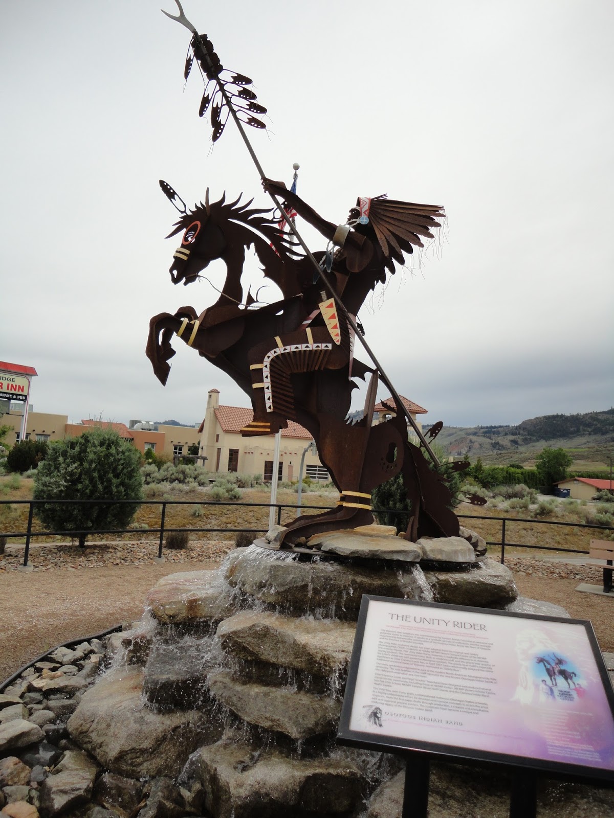
There are two centres dedicated to preserving the ecosystem of the Okanagan Desert. The Osoyoos Desert Centre is located 3 km north of Osoyoos off Highway 97,[26] while theNk'Mip Desert Cultural Centre is located adjacent to the Nk'mip Winery on the Osoyoos Indian Reserve.[27]
The area is served by three 18-hole golf courses - Osoyoos Golf and Country Club, Fairview Mountain Golf Club (Oliver) and the Nk’Mip Canyon Desert Golf Course (Oliver) - and one nine-hole course, Sonora Dunes (Osoyoos).
Demographics and development[edit]
| Historical population | ||
|---|---|---|
| Year | Pop. | ±% |
| 1951 | 899 | — |
| 1956 | 860 | −4.3% |
| 1961 | 1,022 | +18.8% |
| 1966 | 1,166 | +14.1% |
| 1971 | 1,285 | +10.2% |
| 1976 | 2,100 | +63.4% |
| 1981 | 2,738 | +30.4% |
| 1986 | 2,956 | +8.0% |
| 1991 | 3,403 | +15.1% |
| 1996 | 4,127 | +21.3% |
| 2001 | 4,295 | +4.1% |
| 2006 | 4,752 | +10.6% |
| 2011 | 4,845 | +2.0% |
| Sources: Statistics Canada[28][29] | ||
The town's popularity among retirees is reflected in the age of the average resident at 58.8 years compared to 40.8 years for the rest of the population of British Columbia. Median household income was $43,764, compared to the $52,709 earned per household on average, province-wide.[30]
The area’s increasing aging population, has sparked the need for increased healthcare services. One proposal (known as the Oasis development) currently before town council includes a five-storey medical-commercial facility.[31] The development also includes three residential buildings between 6 and 10 stories. Despite the town’s small size, an abundance of condominium developments exists.
Sports[edit]
| Club | League | Sport | Venue | Established | Championships |
|---|---|---|---|---|---|
| Osoyoos Coyotes | Ice hockey | Osoyoos Sunbowl Arena |
Notable people[edit]
- Chuck Kobasew - professional hockey player for the NHL's Pittsburgh Penguins
- Jack B. Newton - amateur astronomer
- Alison Smith - television journalist and anchor


Aucun commentaire:
Enregistrer un commentaire