The
Great Wall of China is a series of
fortifications made of stone, brick,
tamped earth, wood, and other materials, generally built along an east-to-west line across the historical northern borders of China to protect the
Chinese states and
empires against the raids and invasions of the various nomadic groups of the
Eurasian Steppe. Several walls were being built as early as the 7th century BC;
[2]these, later joined together and made bigger and stronger, are now collectively referred to as the Great Wall.
[3] Especially famous is the wall built 220–206 BC by
Qin Shi Huang, the first Emperor of China. Little of that wall remains. Since then, the Great Wall has been rebuilt, maintained, and enhanced; the majority of the existing wall is from the
Ming Dynasty (1368–1644).
Other purposes of the Great Wall have included
border controls, allowing the imposition of duties on goods transported along the
Silk Road, regulation or encouragement of trade and the control of immigration and emigration. Furthermore, the defensive characteristics of the Great Wall were enhanced by the construction of watch towers, troop barracks, garrison stations, signaling capabilities through the means of smoke or fire, and the fact that the path of the Great Wall also served as a transportation corridor.
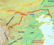
The Great Wall stretches from
Dandong in the east to
Lop Lake in the west, along an arc that roughly delineates the southern edge of
Inner Mongolia. A comprehensive archaeological survey, using advanced technologies, has concluded that the Ming walls measure 8,850 km (5,500 mi).
[4] This is made up of 6,259 km (3,889 mi) sections of actual wall, 359 km (223 mi) of trenches and 2,232 km (1,387 mi) of natural defensive barriers such as hills and rivers.
[4] Another archaeological survey found that the entire wall with all of its branches measure out to be 21,196 km (13,171 mi).
[5]
Names
The collection of fortifications now known as "The Great Wall of China" has historically had a number of different names in both Chinese and English.
The longer Chinese name "Ten-Thousand-
Mile Long Wall" (萬里長城,
Wanli Changcheng) came from Sima Qian's description of it in the
Records, though he did not name the walls as such. The
ad 493
Book of Song quotes the frontier general
Tan Daoji referring to "the long wall of 10,000 miles", closer to the modern name, but the name rarely features in pre-modern times otherwise. The
traditional Chinese mile (
里,
lǐ) was an often irregular distance that was intended to show the length of a standard village and varied with terrain but was usually
standardized at distances around a third of an
English mile (540 m).
[10] Since China's
metrication in 1930, it has been exactly equivalent to 500 metres or 1,600 feet,
[11] which would make the wall's name describe a distance of 5,000 km (3,100 mi). However, this use of "ten-thousand" (
wàn) is
figurative in a similar manner to the Greek and English
myriad and simply means "innumerable" or "immeasurable".
[12]
Because of the wall's association with the First Emperor's
supposed tyranny, the
Chinese dynasties after
Qin usually avoided referring to their own additions to the wall by the name "Long Wall". Instead, various terms were used in medieval records, including "frontier(s)" (
塞,
sāi), "rampart(s)" (
垣,
yuán), "barrier(s)" (
障,
zhàng), "the outer fortresses"
(外堡, wàibǎo), and "the border wall(s)"
(t 邊牆, s 边墙, biānqiáng). Poetic and informal names for the wall included "the Purple Frontier"
(紫塞, Zǐsāi) and "the Earth Dragon"
(t 土龍, s 土龙, Tǔlóng). Only during the
Qing period did "Long Wall" become the catch-all term to refer to the many border walls regardless of their location or dynastic origin, equivalent to the English "Great Wall".
The current English name evolved from accounts of
"the Chinese wall" from early modern European travelers. By the 19th century, "The Great Wall of China" had become standard in English, French, and German, although other European languages continued to refer to it as "the Chinese wall".
[12]
History
Early walls
The Great Wall of the
Qin

The Great Wall of the
Han
The Chinese were already familiar with the techniques of
wall-building by the time of the
Spring and Autumn period between the 8th and 5th centuries BC.
[19] During this time and the subsequent
Warring States period, the states of
Qin,
Wei,
Zhao,
Qi,
Yan, and
Zhongshan[20][21] all constructed extensive fortifications to defend their own borders. Built to withstand the attack of small arms such as swords and spears, these walls were made mostly by stamping earth and gravel between board frames.
King Zheng of
Qin conquered the last of his opponents and unified China as the
First Emperor of the
Qin dynasty ("Qin Shi Huang") in 221 BC. Intending to impose centralized rule and prevent the resurgence of feudal lords, he ordered the destruction of the sections of the walls that divided his empire among the former states. To position the empire against the
Xiongnu people from the north, however, he ordered the building of new walls to connect the remaining fortifications along the empire's northern frontier. Transporting the large quantity of materials required for construction was difficult, so builders always tried to use local resources. Stones from the mountains were used over mountain ranges, while
rammed earth was used for construction in the plains. There are no surviving historical records indicating the exact length and course of the Qin walls. Most of the ancient walls have eroded away over the centuries, and very few sections remain today. The human cost of the construction is unknown, but it has been estimated by some authors that hundreds of thousands, if not up to a million, workers died building the Qin wall.
[24] Later, the
Han,
[25] the
Sui, and the
Northern dynasties all repaired, rebuilt, or expanded sections of the Great Wall at great cost to defend themselves against northern invaders. The
Tang and
Song dynasties did not undertake any significant effort in the region. The
Liao,
Jin, and
Yuan dynasties, who ruled Northern China throughout most of the 10th–13th centuries, constructed defensive walls in the 12th century but those were located much to the north of the Great Wall as we know it, within China's province of
Inner Mongolia and in
Mongolia itself.
Ming era
The Great Wall concept was revived again under the
Ming in the 14th century, and following the Ming army's defeat by the
Oirats in the
Battle of Tumu. The Ming had failed to gain a clear upper hand over the
Mongolian tribes after successive battles, and the long-drawn conflict was taking a toll on the empire. The Ming adopted a new strategy to keep the nomadic tribes out by constructing walls along the northern border of China. Acknowledging the Mongol control established in the
Ordos Desert, the wall followed the desert's southern edge instead of incorporating the bend of the
Yellow River.
Unlike the earlier fortifications, the Ming construction was stronger and more elaborate due to the use of bricks and stone instead of rammed earth. Up to 25,000 watchtowers are estimated to have been constructed on the wall. As
Mongol raids continued periodically over the years, the Ming devoted considerable resources to repair and reinforce the walls. Sections near the Ming capital of Beijing were especially strong.
Qi Jiguang between 1567 and 1570 also repaired and reinforced the wall, faced sections of the ram-earth wall with bricks and constructed 1,200 watchtowers from Shanhaiguan Pass to Changping to warn of approaching Mongol raiders.
[31] During the 1440s–1460s, the Ming also built a so-called "Liaodong Wall". Similar in function to the Great Wall (whose extension, in a sense, it was), but more basic in construction, the Liaodong Wall enclosed the agricultural heartland of the
Liaodong province, protecting it against potential incursions by Jurched-Mongol Oriyanghan from the northwest and the
Jianzhou Jurchens from the north. While stones and tiles were used in some parts of the Liaodong Wall, most of it was in fact simply an earth dike with moats on both sides.
Towards the end of the Ming, the Great Wall helped defend the empire against the
Manchu invasions that began around 1600. Even after the loss of all of
Liaodong, the Ming army held the heavily fortified
Shanhai Pass, preventing the Manchus from conquering the Chinese heartland. The Manchus were finally able to cross the Great Wall in 1644, after Beijing had already fallen to
Li Zicheng's rebels. Before this time, the Manchus had crossed the Great Wall multiple times to raid, but this time it was for conquest. The gates at Shanhai Pass were opened on May 25 by the commanding Ming general,
Wu Sangui, who formed an alliance with the Manchus, hoping to use the Manchus to expel the rebels from Beijing. The Manchus quickly seized Beijing, and eventually defeated both the rebel-founded
Shun dynasty and the
remaining Ming resistance, establishing the
Qing dynasty rule over all of China.
Under Qing rule, China's borders extended beyond the walls and Mongolia was annexed into the empire, so constructions on the Great Wall were discontinued. On the other hand, the so-called
Willow Palisade, following a line similar to that of the Ming Liaodong Wall, was constructed by the Qing rulers in Manchuria. Its purpose, however, was not defense but rather migration control.
Foreign accounts of the Wall
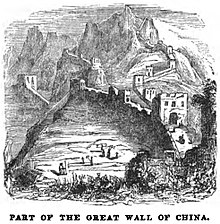
Part of the Great Wall of China (April 1853, X, p. 41)
[35]
Soon after Europeans reached Ming China by ship in the early 16th century, accounts of the Great Wall started to circulate in Europe, even though no European was to see it for another century. Possibly one of the earliest European descriptions of the wall and of its significance for the defense of the country against the "
Tartars" (i.e. Mongols), may be the one contained in
João de Barros's 1563
Asia.
[41] Other early accounts in Western sources include those of
Gaspar da Cruz,
Bento de Goes,
Matteo Ricci, and Bishop
Juan González de Mendoza. In 1559, in his work "A Treatise of China and the Adjoyning Regions," Gaspar da Cruz offers an early discussion of the Great Wall. Perhaps the first recorded instance of a European actually entering China via the Great Wall came in 1605, when the Portuguese Jesuit brother
Bento de Góis reached the northwestern
Jiayu Pass from India. Early European accounts were mostly modest and empirical, closely mirroring contemporary Chinese understanding of the Wall, although later they slid into hyperbole, including the erroneous but ubiquitous claim that the Ming Walls were the same ones that were built by the First Emperor in the 3rd century BC.
When China opened its borders to foreign merchants and visitors after its defeat in the
First and
Second Opium Wars, the Great Wall became a main attraction for tourists. The travelogues of the later 19th century further enhanced the reputation and the mythology of the Great Wall, such that in the 20th century, a persistent misconception exists about the Great Wall of China being visible from the Moon or even Mars.
Course

The main sections of the Great Wall that are still standing today
An area of the sections of the Great Wall at
Jinshanling
Although a formal definition of what constitutes a "Great Wall" has not been agreed upon, making the full course of the Great Wall difficult to describe in its entirety, the course of the main Great Wall line following Ming constructions can be charted.
The
Jiayu Pass, located in Gansu province, is the western terminus of the Ming Great Wall. Although Han fortifications such as
Yumen Pass and the
Yang Pass exist further west, the extant walls leading to those passes are difficult to trace. From Jiayu Pass the wall travels discontinuously down the
Hexi Corridor and into the deserts of
Ningxia, where it enters the western edge of the Yellow River loop at
Yinchuan. Here the first major walls erected during the Ming dynasty cuts through the
Ordos Desert to the eastern edge of the Yellow River loop. There at Piantou Pass
(t 偏頭關, s 偏头关, Piāntóuguān) in
Xinzhou,
Shanxi province, the Great Wall splits in two with the "Outer Great Wall"
(t 外長城, s 外长城, Wài Chǎngchéng) extending along the Inner Mongolia border with Shanxi into
Hebei province, and the "inner Great Wall"
(t 內長城, s 內长城, Nèi Chǎngchéng) running southeast from Piantou Pass for some 400 km (250 mi), passing through important passes like the
Pingxing Pass and
Yanmen Pass before joining the Outer Great Wall at Sihaiye
(四海冶, Sìhǎiyě), in Beijing's
Yanqing County.
The sections of the Great Wall around Beijing municipality are especially famous: they were frequently renovated and are regularly visited by tourists today. The
Badaling Great Wall near
Zhangjiakou is the most famous stretch of the Wall, for this is the first section to be opened to the public in the People's Republic of China, as well as the showpiece stretch for foreign dignitaries. South of Badaling is the
Juyong Pass; when used by the Chinese to protect their land, this section of the wall had many guards to defend China's capital Beijing. Made of stone and bricks from the hills, this portion of the Great Wall is 7.8 m (25 ft 7 in) high and 5 m (16 ft 5 in) wide.
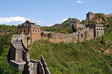
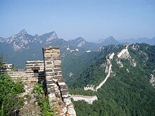
One of the most striking sections of the Ming Great Wall is where it climbs extremely steep slopes in
Jinshanling. There it runs 11 km (7 mi) long, ranges from 5 to 8 m (16 ft 5 in to 26 ft 3 in) in height, and 6 m (19 ft 8 in) across the bottom, narrowing up to 5 m (16 ft 5 in) across the top. Wangjinglou
(t 望京樓, s 望京楼, Wàngjīng Lóu) is one of Jinshanling's 67
watchtowers, 980 m (3,220 ft) above sea level. Southeast of Jinshanling is the
Mutianyu Great Wall which winds along lofty, cragged mountains from the southeast to the northwest for 2.25 km (1.40 mi). It is connected with Juyongguan Pass to the west and Gubeikou to the east. This section was one of the first to be renovated following the turmoil of the
Cultural Revolution.
At the edge of the Bohai Gulf is Shanhai Pass, considered the traditional end of the Great Wall and the "First Pass
Under Heaven". The part of the wall inside Shanhai Pass that meets the sea is named the "Old Dragon Head". 3 km (2 mi) north of Shanhai Pass is Jiaoshan Great Wall (焦山長城), the site of the first mountain of the Great Wall.
[51] 15 km (9 mi) northeast from Shanhaiguan is Jiumenkou
(t 九門口, s 九门口, Jiǔménkǒu), which is the only portion of the wall that was built as a bridge. Beyond Jiumenkou, an offshoot known as the Liaodong Wall continues through
Liaoning province and terminates at the
Hushan Great Wall, in the city of
Dandong near the
North Korean border.
[52]
In 2009, 180 km of previously unknown sections of the wall concealed by hills, trenches and rivers were discovered with the help of infrared range finders and
GPS devices.
[53] In March and April 2015 nine sections with a total length of more than 10 km (6 mi), believed to be part of the Great Wall, were discovered along the border of
Ningxia autonomous region and Gansu province.
[54]
Characteristics
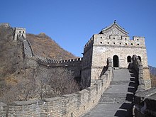
The Great Wall at Mutianyu, near Beijing
Before the use of bricks, the Great Wall was mainly built from rammed earth, stones, and wood. During the Ming, however, bricks were heavily used in many areas of the wall, as were materials such as tiles,
lime, and stone. The size and weight of the bricks made them easier to work with than earth and stone, so construction quickened. Additionally, bricks could bear more weight and endure better than rammed earth. Stone can hold under its own weight better than brick, but is more difficult to use. Consequently, stones cut in rectangular shapes were used for the foundation, inner and outer
brims, and gateways of the wall.
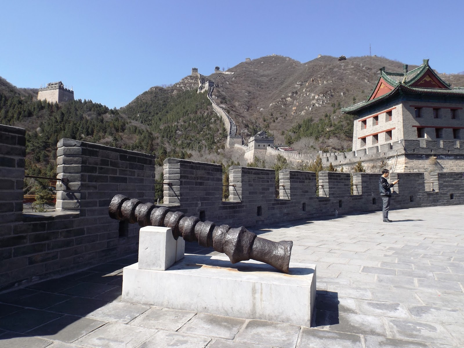
Battlements line the uppermost portion of the vast majority of the wall, with defensive gaps a little over 30 cm (12 in) tall, and about 23 cm (9.1 in) wide. From the parapets, guards could survey the surrounding land. Communication between the army units along the length of the Great Wall, including the ability to call reinforcements and warn
garrisons of enemy movements, was of high importance. Signal towers were built upon hill tops or other high points along the wall for their visibility. Wooden gates could be used as a trap against those going through. Barracks, stables, and armories were built near the wall's inner surface.
Condition
A more rural portion of the Great Wall that stretches throughout the mountains, here seen in slight disrepair

A view of the Great Wall ranging across a mountain, from another part of the Great Wall, near Beijing.
While some portions north of Beijing and near tourist centers have been preserved and even extensively renovated, in many locations the Wall is in disrepair. Those parts might serve as a village playground or a source of stones to rebuild houses and roads.
[56] Sections of the Wall are also prone to
graffiti and
vandalism, while inscribed bricks were pilfered and sold on the market for up to 50
renminbi.
[57] Parts have been destroyed because the Wall is in the way of construction.
[58] A 2012 report by the
State Administration of Cultural Heritage states that 22% of the Ming Great Wall has disappeared, while 1,961 km (1,219 mi) of wall have vanished.
[57] More than 60 km (37 mi) of the wall in
Gansu province may disappear in the next 20 years, due to erosion from
sandstorms. In places, the height of the wall has been reduced from more than 5 m (16 ft 5 in) to less than 2 m (6 ft 7 in). Various square lookout towers that characterize the most famous images of the wall have disappeared. Many western sections of the wall are
constructed from mud, rather than brick and stone, and thus are more susceptible to erosion.
[59] In 2014 a portion of the wall near the border of Liaoning and Hebei province was repaired with concrete. The work has been much criticized.
[60]
Visibility from space
From the Moon
One of the earliest known references to the myth that the Great Wall can be seen from the
moon appears in a letter written in 1754 by the English antiquary
William Stukeley. Stukeley wrote that, "This
mighty wall of four score miles [130 km] in length is only exceeded by the Chinese Wall, which makes a considerable figure upon the
terrestrial globe, and may be discerned at the Moon."
[61] The claim was also mentioned by
Henry Norman in 1895 where he states "besides its age it enjoys the reputation of being the only work of human hands on the globe visible from the Moon."
[62] The issue of
"canals" on Mars was prominent in the late 19th century and may have led to the belief that long, thin objects were visible from space. The claim that the Great Wall is visible from the moon also appears in 1932's
Ripley's Believe It or Not! strip
[63] and in
Richard Halliburton's 1938 book
Second Book of Marvels.
The claim the Great Wall is visible from the moon has been debunked many times,
[64] but is still ingrained in popular culture.
[65] The wall is a maximum 9.1 m (29 ft 10 in) wide, and is about the same color as the soil surrounding it. Based on the optics of resolving power (distance versus the width of the iris: a few millimeters for the human eye, meters for large telescopes) only an object of reasonable contrast to its surroundings which is 110 km (70 mi) or more in diameter (1 arc-minute) would be visible to the unaided eye from the Moon, whose average distance from Earth is 384,393 km (238,851 mi). The apparent width of the Great Wall from the Moon is the same as that of a human hair viewed from 3 km (2 mi) away. To see the wall from the Moon would require spatial resolution 17,000 times better than normal (20/20) vision. Unsurprisingly, no lunar astronaut has ever claimed to have seen the Great Wall from the Moon.
From low Earth orbit

A satellite image of a section of the Great Wall in northern Shanxi, running diagonally from lower left to upper right and not to be confused with the more prominent river running from upper left to lower right. The region pictured is 12 km × 12 km (7 mi × 7 mi).
A more controversial question is whether the Wall is visible from
low Earth orbit (an altitude of as little as 160 km (100 mi)).
NASA claims that it is barely visible, and only under nearly perfect conditions; it is no more conspicuous than many other man-made objects.
[67] Other authors have argued that due to limitations of the optics of the eye and the spacing of
photoreceptors on the
retina, it is impossible to see the wall with the naked eye, even from low orbit, and would require
visual acuity of 20/3 (7.7 times better than normal).
Astronaut
William Pogue thought he had seen it from
Skylab but discovered he was actually looking at the
Grand Canal of China near Beijing. He spotted the Great Wall with binoculars, but said that "it wasn't visible to the unaided eye." U.S. Senator
Jake Garn claimed to be able to see the Great Wall with the naked eye from a
space shuttle orbit in the early 1980s, but his claim has been disputed by several U.S. astronauts. Veteran U.S. astronaut
Gene Cernan has stated: "At Earth orbit of 100 to 200 miles [160 to 320 km] high, the Great Wall of China is, indeed, visible to the naked eye."
Ed Lu,
Expedition 7 Science Officer aboard the
International Space Station, adds that, "it's less visible than a lot of other objects. And you have to know where to look."
In 2001,
Neil Armstrong stated about the view from
Apollo 11: "I do not believe that, at least with my eyes, there would be any man-made object that I could see. I have not yet found somebody who has told me they've seen the Wall of China from Earth orbit. ... I've asked various people, particularly Shuttle guys, that have been many orbits around China in the daytime, and the ones I've talked to didn't see it."
[68]
In October 2003, Chinese astronaut
Yang Liwei stated that he had not been able to see the Great Wall of China. In response, the
European Space Agency (ESA) issued a press release reporting that from an orbit between 160 and 320 km (100 and 200 mi), the Great Wall is visible to the naked eye. In an attempt to further clarify things, the ESA published a picture of a part of the "Great Wall" photographed from low orbit. However, in a press release a week later, they acknowledged that the "Great Wall" in the picture was actually a river.
Leroy Chiao, a Chinese-American astronaut, took a photograph from the
International Space Station that shows the wall. It was so indistinct that the photographer was not certain he had actually captured it. Based on the photograph, the
China Daily later reported that the Great Wall can be seen from 'space' with the naked eye, under favorable viewing conditions, if one knows exactly where to look.
[69] However, the resolution of a camera can be much higher than the human visual system, and the optics much better, rendering photographic evidence irrelevant to the issue of whether it is visible to the naked eye.
Gallery
See also
*****************************************************
Vạn Lý Trường Thành được xem như công trình vĩ đại nhất Trung Quốc mà bất cứ khách đi tour Bắc Kinh hay chùm Tour Trung Quốc cũng nên đến tham quan một lần. Thật vậy, Vạn Lý Trường Thành là một trong những kỳ quan nhân tạo lâu đời nhất và hùng vĩ nhất còn tồn tại đến ngày nay, biểu tượng của nền văn minh Trung Quốc cổ đại. Hãy cùng chúng tôi tìm hiểu về Vạn Lý Trường Thành để có những kinh nghiệm tốt nhất trước khi tự mình khám phá kỳ quan có một không hai này nhé!
Vạn Lý Trường Thành ở đâu?
Vạn Lý Trường Thành
Nhiều người đã nghĩ Vạn Lý Trường Thành là công trình ở Bắc Kinh nhưng Vạn Lý Trường Thành (tiếng Trung: 万里长城 (Thành dài vạn lý), tiếng Anh: Great Wall of China) thật ra là tên gọi chung của tập hợp nhiều thành lũy bằng đất đá được xây dựng từ khoảng 2500 năm trước trong thời Tây Chu, kéo dài ngàn vạn cây số từ phía Đông sang Tây, có chức năng như một tuyến phòng thủ quân sự bảo vệ Trung Hoa khỏi những cuộc xâm lược của các bộ tộc du mục phương Bắc như Mông Cổ, Mãn Châu. Bởi vai trò quan trọng này mà nó được kéo dài liên tục trong suốt 2000 năm sau đó, cho đến cuối triều đại nhà Minh, mở rộng ra 15 tỉnh thành của Trung Quốc, mang hình dạng uốn lượn của Rồng.
Bản đồ những nơi Vạn Lý Trường Thành đi qua còn giữ được đến ngày
Qua hàng ngàn năm, qua các triều đại, nhiều phần của Vạn Lý Trường Thành đã bị tàn phá nghiêm trọng do cả tác động của chiến tranh, con người và thiên nhiên. Vạn Lý Trường Thành mà khách đi tour Bắc Kinh giá rẻ được khám phá ngày nay chủ yếu được xây dựng dưới thời nhà Minh, từ 1368 – 1647, bắt đầu từ Hổ Sơn (Liêu Ninh) và kết thúc ở Gia Dục Quan (Cam Túc). Theo các nghiên cứu khảo cổ, Vạn Lý Trường Thành dài khoảng 8.850km nhưng theo số liệu năm 2012, chiều dài của Vạn Lý Trường Thành lên đến 21.196km.

Vạn Lý Trường Thành - Kim Sơn Lĩnh
Ngày nay, những phần nổi tiếng nhất của bức tường thành vạn dặm này là Bát Đạt Lĩnh (Badaling), Mộ Điền Dục (Mutianyu), Kim Sơn Lĩnh (Jinshanling), Tư Mã Đài (Simatai), Cửa ải Gia Dục Quan, Cư Dung Quan, Sơn Hải Quan.
Trong đó, Mộ Điền Dục là phần tường thành được gợi ý cho du khách tour Bắc Kinh giá rẻ đến nhiều nhất còn Kim Sơn Lĩnh và Tư Mã Đài lại thích hợp hơn cho hoạt động đi bộ đường dài.
.jpg)
Nhìn từ xa, Vạn Lý Trường Thành như một con rồng trắng nằm trên triền núi
Vạn Lý Trường Thành như một bản trường ca gắn liền với ý chí bền bỉ, lịch sử bi tráng hào hùng của nhân dân Trung Hoa. Bởi vậy, với những người đam mê nghiên cứu lịch sử, theo tour Bắc Kinh từ Hà Nội, bạn sẽ được thỏa mãn với những kiến thức tự mình thu được hoặc qua những câu chuyện được giới thiệu bới hướng dẫn viên. Và kể cả bạn không quá am hiểu hay quan tâm đến lịch sử thì phong cảnh ở Vạn Lý Trường Thành cũng đủ xinh đẹp nên thơ khiến bạn “đi một lần nhớ mãi”.
Bí mật về Vạn Lý Trường Thành là gì?
.jpg)
1. Vạn Lý Trường Thành không thể nhìn thấy được từ vũ trụ bằng mắt thường. Trước đây khi con người chưa thám hiểm không gian, nhiều người đã lầm tưởng Van Lý Trường Thành – với những đường nét to lớn trên bề mặt địa cầu – có thể nhìn thấy rõ từ Mặt Trăng. Tuy nhiên sự thật là bức tường thành này không thể nhìn thấy từ không gian bằng mắt thường hay máy ảnh, giống như so sánh nhìn một sợi tóc từ cách đó 3km vậy.
2. Du khách sẽ bị phạt khoảng 5000 tệ (17 triệu đồng) nếu bị bắt quả tang lấy gạch từ di tích Vạn Lý Trường Thành. Du khách đi tour Bắc Kinh nhớ là chỉ nên chụp ảnh lưu niệm ở đây chứ đừng mang gạch, các phần khác của tường thành mang về hay viết vẽ lên tường thành nhé. Nếu không bạn sẽ vô tình vướng vào những rắc rối không đáng có đấy.
3. Vạn Lý Trường Thành không phải một bức tường thành dài liên tục mà còn có các bức tường bên sườn, tường vòng tròn và tường song song. Cũng có phần không có tường mà được thay thế bằng “thành lũy tự nhiên” tạo nên từ núi cao và sông ngòi. Vào thời Tần (221 – 206 trước Công Nguyên), bột gạo nếp được sử dụng như chất kết dính cho các viên gạch tạo nên tường thành.
4. Truyền thuyết nổi bật nhất về Vạn Lý Trường Thành là chuyện “Mạnh Khương Nữ khóc Trường Thành” kể về nàng Mạnh Khương Nữ có chồng là một thư sinh, ngay đêm tân hôn bị triều đình bắt đi xây dựng Vạn Lý Trường Thành. Khi đông đến, nàng đan áo cho chồng và đi khắp chiều dài Trường Thành hỏi thăm và nhận được tin dữ chồng mình đã chết vùi thây dưới Trường Thành. Nàng khóc 3 ngày 3 đêm, nước mắt hòa lẫn máu. Nước mắt Mạnh Khương Nữ vang xa 800 dặm Trường Thành, làm đổ sập một khúc tường thành, lộ ra xác chết chồng mình. Nàng an tang cho chồng xong liền nhảy xuống biển tự vẫn. Câu chuyện này trở 1 trong 4 truyền thuyết dân gian nổi tiếng nhất văn hóa Trung Hoa, bên cạnh Ngưu Lang Chức Nữ, Bạch Xà truyện và Lương Sơn Bá Chúc Anh Đài.
.jpg)
Tượng Mạnh Khương Nữ ở Sơn Hải Quan - Vạn Lý Trường Thành
Ngày này, du khách đi tour Trung Quốc giá rẻ đến Vạn Lý Trường Thành có thể đến thăm miếu thờ Mạnh Khương Tử ở phần tường thành quận Sơn Hải Quan, Hà Bắc.
5. Trong Cách Mạng Văn Hóa (1966 – 1976) nhiều viên gạch của Vạn Lý Trường Thành đã được dung vào việc xây nhà, trang trại, hồ chứa. Đây cũng là một trong những lý do Vạn Lý Trường Thành bị tàn phá do nhân tạo. Không chỉ vậy, các phần Vạn Lý Trường Thành ở Cam Túc và Ninh Hạ có khả năng biến mất sau 20 năm, do sa mạc hóa và cách sử dụng đất của con người.
6. Phần nổi tiếng nhất của Vạn Lý Trường Thành – Bát Đạt Lĩnh được hơn 300 nguyên thủ quốc gia và nhân vật VIP từ khắp nơi trên thế giới đến tham quan. Người đầu tiên trong số đó là chính khách Liên Xô Klim Voroshilov, 1957. Tổng thống Barack Obama, Nữ hoàng Elizabeth II, Tom Cruise hay Jennifer Lawrence cũng là những nhân vật nổi tiếng đã đến nơi này.

"Người sói" Hugh Jackman cũng đã từng ghé thăm Vạn Lý Trường Thành
7. Lực lượng lao động chính tạo nên Vạn Lý Trường Thành gồm có các binh sĩ, nông dân và tù binh, tù nhân phạm tội. Ước tính số lượng lên tới 800.000 người. Hàng ngàn người đã chết trong quá trình xây dựng bức Trường Thành này, trong đó một số được chôn cất ngay dưới móng tường thành, nhiều đến mức Vạn Lý Trường Thành còn được mệnh danh là “Nghĩa trang dài nhất thế giới”. Tuy vậy những câu chuyện kinh dị truyền miệng như gạch vữa xây nên Vạn Lý Trường Thành được trộn từ xương người là hoàn toàn không có thật. Vữa xây Trường Thành gồm nhiều loại vật liệu khác nhau qua các thời kỳ, từ bột gạo, đất sét, đá đến gạch vun, gỗ, đá vôi…
Tham gia tour Bắc Kinh đến Vạn Lý Trường Thành, bạn sẽ còn được hướng dẫn viên kể thêm thật nhiều điều thú vị xung quanh bức tường thành dài nhất thế giới này nữa đấy!
Tham quan những gì ở Vạn Lý Trường Thành?
Trường thành Bát Đạt Lĩnh
.jpg)
Trường Thành Bát Đạt Lĩnh - Vạn Lý Trường ThànhBát Đạt Lĩnh là đoạn Trường Thành được trùng tu tốt nhất, được phần lớn du khách đi tour Bắc Kinh ghé thăm, cách trung tâm Bắc Kinh 80km về phía Tây Bắc, thuộc địa phận huyện Diên Khánh, Bắc Kinh. Đoạn Trường Thành chạy qua địa điểm này được xây dựng năm 1505 thời nhà Minh. Khúc Trường Thành tại Bát Đạt Lĩnh này là phần tham quan đầu tiên được mở cửa, vào năm 1957. Nhìn từ xa, Bát Đạt Lĩnh cong cong, dốc thoai thoải, như lưng rồng trắng uốn lượn trên triền núi xanh tươi bát ngát, làm choáng ngợp biết bao du khách đi du lịch Bắc Kinh.
Cửa Ải Gia Dục Quan

Vạn Lý Trường Thành Gia Dục Quan nằm im lìm giữa sa mạc Gobi, không đông đúc, náo nhiệt như ở Bắc Kinh, thích hợp hơn với những hoạt động đi bộ đường dài
Cửa Ải Gia Dục Quan, hay còn gọi là Pháo Đài Gia Dục Quan, là cửa ải đầu tiên ở phía Tây Vạn Lý Trường Thành, tỉnh Cam Túc, Trung Quốc. Đây là một trong những cửa ải chính của Vạn Lý Trường Thành, cùng với Cư Dung Quan và Sơn Hải Quan. Nơi đây được mệnh danh là “cửa ải lớn nhất thiên hạ”, xây dựng từ năm 1372, thời nhà Minh. Cửa ải này còn là một điểm quan trọng trên Con đường tơ lụa cổ đại..jpg)
Gia Dục Quan giữa nắng sa mạc
Truyền thuyết kể rằng khi Gia Dục Quan mới ở trên bản vẽ thiết kế, quan phụ trách đã yêu cầu người thiết kế ước lượng số viên gạch cần đến. Người này đã lên kế hoạch tỉ mỉ, cần 99.999 + 1 viên gạch để xây thành lũy. Khi pháo đài hoàn thành thì chính xác thừa đúng 1 viên. Viên gạch đó đến nay vẫn được đặt trang trọng trên cổng thành Gia Dục Quan.
Cửa Ải Sơn Hải Quan
.jpg)
Cửa Ải Sơn Hải Quan - Vạn Lý Trường Thành
.jpg)
Miếu Hải Thần - Sơn Hải Quan
Sơn Hải Quan hay Du Quan, là một trong 3 ải chính của Vạn Lý Trường Thành. Nơi bức tường thành này giáp với biển Bột Hải được gọi là “Lão Long Đầu”. Cửa ải này mang danh “Cửa ải đầu tiên dưới Thiên đường”. Khách du lịch Trung Quốc đến Sơn Hải Quan luôn tìm đến 3 địa điểm hấp dẫn này:
Bảo Tàng Vạn Lý Trường Thành nằm trong pháo đài, trưng bày một số hình ảnh, di vật, quần áo và những câu chuyện xung quanh công trình này.

Bảo tàng Vạn Lý Trường Thành
Lão Long Đầu (Đầu ông rồng già) là phần pháo đài của Trường Thành giáp với biển Bột Hải. Cái tên này bắt nguồn từ hình tượng Vạn Lý Trường Thành uốn lượn như một con rồng mà phần tiếp giáp với bờ biển Bột Hải lại như cái đầu rồng đang cúi xuống uống nước.
.jpg)
Lão Long Đầu - Sơn Hải Quan
Miếu thờ Mạnh Khương Nữ. Đây chính là đền thờ nàng Mạnh Khương trong truyền thuyết đã được đề cập ở phần Bí mật về Vạn Lý Trường Thành.
.jpg)
Tượng Mạnh Khương Nữ - Một trong những biểu tượng ở Sơn Hải Quan
Không chỉ có 3 địa điểm này, đi theo tour Trung Quốc giá rẻ bạn sẽ còn được tham quan nhiều khung cảnh thật đẹp, với ý nghĩa lịch sử gắn liền với Trung Hoa ở Trường Thành này nữa đấy.
Di chuyển đến Vạn Lý Trường Thành như nào?
Đến với tour Bắc Kinh từ Hà Nội du khách đến Bắc Kinh có thể bay thẳng từ sân bay quốc tế Nội Bài. Có rất nhiều hãng hàng không bay thẳng tới Bắc Kinh như Viet Nam Airlines, Vietjet, China Southern Airlines, China Airlines...cách di chuyển này phù hợp với người già, trẻ nhỏ, chỉ cần mất một khoảng thời gian ngắn bạn đã đặt chân được đến thành phố Bắc Kinh xinh đẹp này rồi.
Nếu đi theo tour Bắc Kinh đến Vạn Lý Trường Thành, bạn sẽ được hướng dẫn viên đưa đón tận nơi không phải lo đến chuyện xe cộ nhưng nếu bạn đi tự túc thì Trường Thành cách trung tâm thành phố khoảng 200km, vì vậy bạn hãy chọn tàu điện hoặc xe bus làm phương tiện di chuyển đến địa điểm du lịch này nhé.
.jpg)
Sơ đồ thời gian di chuyển từ Trung Tâm Bắc Kinh và đi giữa các phần Vạn Lý Trường Thành gần Bắc Kinh
Cần lưu ý gì khi đến Vạn Lý Trường Thành?
Để khám phá hết công trình này, khách đi tour Bắc Kinh cần có thể lực tốt, bạn sẽ phải đi bộ khá nhiều vì vậy không nên đi giày cao gót hay sandal. Hãy chọn giày thể thao hoặc giày leo núi để tiện cho hành trình khám phá Vạn Lý Trường Thành nhé.
.jpg)
Không chỉ có những đoạn dốc, Vạn Lý Trường Thành còn có vô số những bậc thanh cao ngút, đòi hỏi bạn phải có thể lực thật tốt
Đến thăm Vạn Lý Trường Thành vào buổi sáng bạn nên sẵn sàng hành trang áo khoác, kem chống nắng, ô, nón bởi buổi sáng ở đây rất nắng, nếu đến thăm vào buổi chiều tối nên mang theo áo khoác mỏng để tránh bị cảm lạnh. Mùa đông thì nên mặc áo rét thật ấm nhé. Một lưu ý nữa là hành trình chinh phục Vạn Lý Trường Thành khá dài nên bạn hãy mang theo nước hoặc đồ ăn nhẹ để ăn dọc đường.
►Nên đi Vạn Lý Trường Thành vào mùa nào?
Dù là Đông, Xuân hay Thu Hạ, đến thăm Vạn Lý Trường Thành vào bất cứ thời điểm nào trong năm, khách du lịch Bắc Kinh cũng có thể chiêm ngưỡng trọn vẹn cảnh sắc nơi đây. Mùa xuân trăm hoa đua nở, Vạn Lý Trường Thành mềm mại, dịu dàng như con rồng trắng nằm giữa muôn hoa. Sang hạ nắng vàng soi nhè nhẹ, thu đến lá thay màu đỏ rực, biến khung cảnh bình yên trở nên lãng mạn hơn bao giờ hết. Sang đông, Vạn Lý Trường Thành hơi chút u tịch, mang trên mình cái lạnh phương Bắc nhưng đứng giữa đất trời nơi đây, được ngắm nhìn tuyết rơi phủ trắng xóa cả dãy thành dài, cảm giác này thật đáng để đánh đổi so với cái lạnh phải không?
.jpg)
Vạn Lý Trường Thành khoác màu áo lãng mạn khi thu về
.jpg)
Gia Dục Quan tĩnh mịch trong tuyết trắng
.jpg)
.jpg)
Vạn Lý Trường Thành tuyết phủ trắng khi đông về
Ngọc Thúy
REF


_-_Copy.jpg)


.jpg)