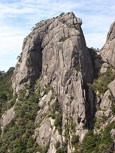
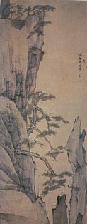
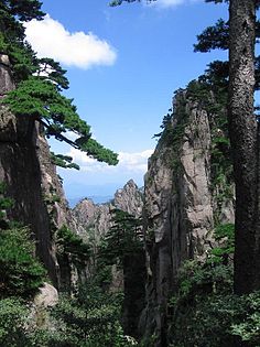
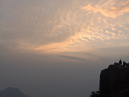
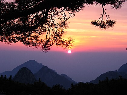
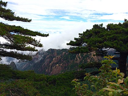
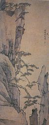
 Huangshan is a frequent subject of traditional Chinese paintings and literature, as well as modern photography. It is a UNESCO World Heritage Site, and one of China's major tourist destinations. Huangshan is also the famous place for Chinese teas of high quality, such as Huangshan Maofeng, Keemun Black, and Blooming Tea (wikipedia ).
Hoàng Sơn là di sản thiên nhiên thế giới UNESCO từ năm 1990 do có vẻ đẹp thiên nhiên khác thường và là nơi sinh sống của nhiều loài quý hiếm bị đe dọa.
Dãy Hoàng Sơn có nhiều đỉnh, trong đó có 77 đỉnh cao quá 1000 m. Ba đỉnh cao nhất của Hoàng Sơn là Đỉnh Liên Hoa (1.864 m,  30°07′B 118°10′Đ), bên cạnh Đỉnh Quang Minh (1.840 m) and Đỉnh Thiên Đô (1.829 m). Di sản thế giới có diện tích 154 km2 và một vùng đệm 142km2

Hoàng Sơn là di sản thiên nhiên thế giới UNESCO từ năm 1990 do có vẻ đẹp thiên nhiên khác thường và là nơi sinh sống của nhiều loài quý hiếm bị đe dọa.
Dãy Hoàng Sơn có nhiều đỉnh, trong đó có 77 đỉnh cao quá 1000 m. Ba đỉnh cao nhất của Hoàng Sơn là Đỉnh Liên Hoa (1.864 m,
 30°07′B 118°10′Đ), bên cạnh Đỉnh Quang Minh (1.840 m) and Đỉnh Thiên Đô (1.829 m). Di sản thế giới có diện tích 154 km2 và một vùng đệm 142km2
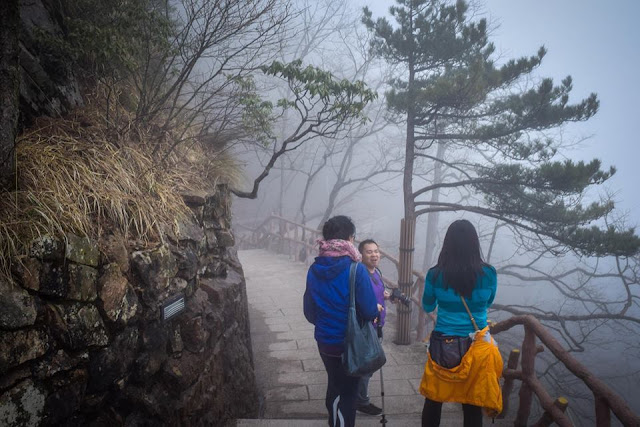
sương mù ẩn hiện
local tour guide
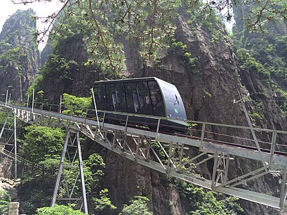
telepherique
đi lên bằng cáp treo cảnh bên ngoài như thần tiên
Oh cảnh đẹp quá !
tranh thủ chụp hình
WOW đá giống người ngồi thiền
nhiều sương mù như cảnh ảo

Chuần bị leo nhiều bậc thang để tham quan vùng cao của Hoàng Sơn
đến nơi rồi
hên qúa lên đỉnh núi trời trong có nắng tha hồ chụp hình

nắng lại hừng lên
Nhà hàng gần đỉnh núi và nắng lại lên rồi
gánh hàng lên restaurant
như tranh phong thủy
Chim lạ vùng này
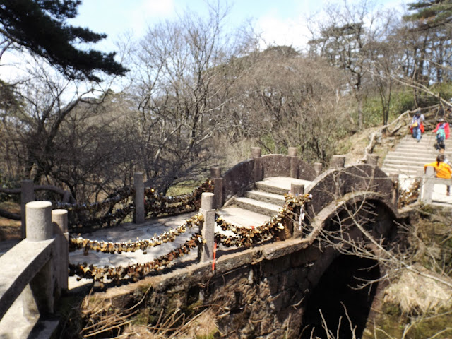
nhiều ống khóa tình yêu giông bên Paris
lúc này nhiều sương mù trở lại như cảnh ảo
nắng lại rồi
lại có nắng đẹp tuyệt
mây mù lại đến
***************************************************************************
Huangshan
From Wikipedia, the free encyclopedia
This article is about the mountain range. For other uses, see Huangshan (disambiguation).
| Huangshan 黄山 | |
|---|---|

Panoramic view of the Huangshan landscape
| |
| Highest point | |
| Elevation | 1,864 m (6,115 ft) [1] |
| Prominence | 1,734 m (5,689 ft) [1] |
| Listing | Ultra |
| Coordinates | 30°07′30″N 118°10′00″ECoordinates: 30°07′30″N 118°10′00″E [1] |
| Geography | |
| Location | Anhui, China |
| Official name | Mount Huangshan |
| Type | Cultural & Natural |
| Criteria | ii, vii, x |
| Designated | 1990 (14th session) |
| Reference no. | 547 |
| State Party | China |
| Region | Asia-Pacific |
| Huangshan | |||

"Huangshan" in Simplified (top) and Traditional (bottom) Chinese characters
| |||
| Simplified Chinese | 黄山 | ||
|---|---|---|---|
| Traditional Chinese | 黃山 | ||
| Literal meaning | "Yellow Mountain(s)" | ||
| |||
Huangshan (Chinese: 黄山),[2] is a mountain range in southern Anhui province in eastern China. Vegetation on the range is thickest below 1,100 meters (3,600 ft), with trees growing up to the treeline at 1,800 meters (5,900 ft).
The area is well known for its scenery, sunsets, peculiarly-shaped granite peaks, Huangshan pine trees, hot springs, winter snow, and views of the clouds from above. Huangshan is a frequent subject of traditional Chinese paintings and literature, as well as modern photography. It is a UNESCO World Heritage Site, and one of China's major tourist destinations. Huangshan is also the famous place for Chinese teas of high quality, such as Huangshan Maofeng, Keemun Black, and Blooming Tea.[citation needed]
Contents
[hide]Physical description[edit]
Huangshan is known for its sunrises,[3] pine trees,[4] "strangely jutting granite peaks",[5] hot springs, winter snow, and views of clouds touching the mountainsides for more than 197 days out of the year.[2][4][5][6]
The Huangshan mountain range has many peaks, some more than 1,000 meters (3,250 feet) high.[7] The three tallest and best-known peaks are Lotus Peak (Lian Hua Feng, 1,864 m), Bright Summit Peak (Guang Ming Ding, 1,840 m), and Celestial Peak (Tian Du Feng, literally Capital of Heaven Peak, 1,829 m).[2][5] The World Heritage Site covers a core area of 154 square kilometres and a buffer zone of 142 square kilometres.[8] The mountains were formed in the Mesozoic, approximately 100 million years ago, when an ancient sea disappeared due to uplift.[9] Later, in the Quaternary Period, the landscape was shaped by the influence of glaciers.[9]
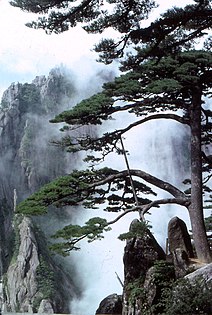
The vegetation of the area varies with elevation. Mesic forests cover the landscape below 1,100 meters. Deciduous forest stretches from 1,100 meters up to the tree line at 1,800 meters. Above that point, the vegetation consists of alpine grasslands. The area has diverse flora, where one-third of China's bryophyte families and more than half of its fern families are represented. The Huangshan pine (Pinus hwangshanensis) is named after Huangshan and is considered an example of vigor because the trees thrive by growing straight out of the rocks.[9] Many of the pine trees in the area are more than a hundred years old and have been given their own names (such as the Ying Ke Pine, or Welcoming-Guests Pine, which is thought to be more than 1500 years old).[5] The pines vary greatly in shape and size, with the most crooked of the trees being considered the most attractive.[6]Furthermore, Huangshan's moist climate facilitates the growing of tea leaves,[10] and the mountain has been called "one of China's premier green tea-growing mountains.[11] Mao feng cha ("Fur Peak Tea"), a well-known local variety of green tea,[12] takes its name from the downy tips of tea leaves found in the Huangshan area.[13]
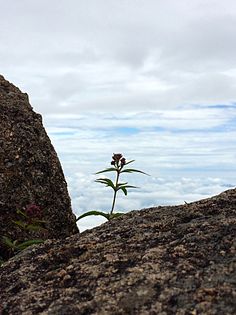
The mountaintops often offer views of the clouds from above, known as the Sea of Clouds (Chinese: 云海; pinyin: yúnhǎi)[10] or "Huangshan Sea"[6] because of the cloud's resemblance to an ocean, and many vistas are known by names such as "North Sea" or "South Sea."[6] One writer remarked on the view of the clouds from Huangshan as follows:
The area also is host to notable light effects, such as the renowned sunrises. Watching the sunrise is considered a "mandatory" part of visiting the area.[3] A phenomenon known as Buddha's Light (Chinese: 佛光; pinyin: fóguāng)[14] is also well-known and, on average, Buddha's Light only appears a couple of times per month.[15] In addition, Huangshan has multiple hot springs, most of them located at the foot of the Purple Cloud Peak. The water stays at 42 °C all year,[16] and has a high concentration of carbonates. The waters are said to help prevent skin, joint, and nerve illness.[9]
History[edit]
Huangshan was formed approximately 100 million years ago and gained its unique rock formations in the Quaternary Glaciation.[9]
During the Qin Dynasty, Huangshan was known as Yishan (Mount Yi). In 747 AD, its name was changed to Huangshan (Mount Huang) by imperial decree;[17] the name is commonly thought to have been coined in honor of Huang Di (the Yellow Emperor), a legendary Chinese emperor, and the mythological ancestor of the Han Chinese.[18] One legend states that Huangshan was the location from which the Yellow Emperor ascended to Heaven.[5] Another legend states that the Yellow Emperor "cultivated moral character and refined Pills of Immortality in the mountains, and in so doing gave the mountains his name.[9] The first use of this name "Huangshan" often is attributed to Chinese poet Li Bai.[18] Huangshan was fairly inaccessible and little-known in ancient times, but its change of name in 747 AD seems to have brought the area more attention; from then on, the area was visited frequently and many temples were built there.[17]
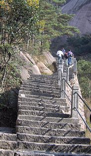
Huangshan is known for its stone steps,[5] carved into the side of the mountain, of which there may be more than 60,000 throughout the area.[3][19][20] The date at which work on the steps began is unknown, but they have been said to be more than 1,500 years old.[19]
Over the years, many scenic spots and physical features on the mountain have been named;[6] many of the names have narratives behind them. For example, one legend tells of a man who did not believe the tales of Huangshan's beauty and went to the mountains to see them; almost immediately, he was converted to the same view. One of the peaks he is said to have visited was named Shixin (始信), roughly meaning "start to believe."[6]
In 1982, Huangshan was declared a "site of scenic beauty and historic interest" by the State Council of the People's Republic of China.[17]It was named a UNESCO World Heritage Site in 1990 for its scenery and for its role as a habitat for rare and threatened species.[4]
Artistic and scientific inspirations[edit]
Much of Huangshan's reputation derives from its significance in Chinese arts and literature.[21] In addition to inspiring poets such as Li Bai,[3][8] Huangshan and the scenery therein has been the frequent subject of poetry and artwork, especially Chinese ink painting[17] and, more recently, photography.[2] Overall, from the Tang Dynasty to the end of the Qing Dynasty, more than 20,000 poems were written about Huangshan, and a school of painting named after it.[5][6] The mountains also have appeared in modern works. James Cameron, director of the 2009 film Avatar, cited Huangshan as one of his influences in designing the fictional world of that film.[22]
The area also has been a location for scientific research because of its diversity of flora and wildlife. In the early part of the twentieth century, the geology and vegetation of Huangshan were the subjects of multiple studies by both Chinese and foreign scientists.[17] The mountain is still a subject of research. For example, in the late twentieth century a team of researchers used the area for a field study of Tibetan macaques, a local species of monkey.[23]
Tourism[edit]
Having at least 140 sections open to visitors,[4] Huangshan is a major tourist destination in China.[2][3] Huangshan City changed its name from Tunxi in 1987 in order to promote Huangshan tourism.[24] In 2007, for instance, more than 1.5 million tourists visited the mountain.[25] The foot of the mountain is linked by rail and by air to Shanghai,[2] and also is accessible from cities such as Hangzhou and Wuhu.[26]
As of 1990, there were more than 50 kilometers of footpaths providing access to scenic areas for visitors and staffers of the facilities.[17]Today there are also cable cars that tourists may use to ride directly from the base to one of the summits.[2] Throughout the area there are hotels and guest houses that accommodate overnight visitors,[2][17] many of whom hike up the mountains, spend the night at one of the peaks to view the sunrise, and then descend by a different route the next day.[3] The area is classified as a AAAAA scenic area by the China National Tourism Administration.[27]
The hotels, restaurants, and other facilities at the top of the mountain are serviced and kept stocked by porters who carry resources up the mountain on foot, hanging their cargo from long poles balanced over their shoulders or backs.[28]
Climate[edit]
Huangshan has an oceanic climate (Cfb) according to the Köppen climate classification. Its elevation makes it colder and wetter than the rest of Anhui.
| [hide]Climate data for Huangshan | |||||||||||||
|---|---|---|---|---|---|---|---|---|---|---|---|---|---|
| Month | Jan | Feb | Mar | Apr | May | Jun | Jul | Aug | Sep | Oct | Nov | Dec | Year |
| Average high °C (°F) | 1 (34) | 2 (36) | 6 (43) | 11 (52) | 15 (59) | 18 (64) | 20 (68) | 19 (66) | 17 (63) | 13 (55) | 8 (46) | 4 (39) | 11.2 (52.1) |
| Daily mean °C (°F) | −2 (28) | −1 (30) | 3 (37) | 8 (46) | 12 (54) | 15 (59) | 18 (64) | 17 (63) | 14 (57) | 9 (48) | 4 (39) | 0 (32) | 8.1 (46.4) |
| Average low °C (°F) | −6 (21) | −4 (25) | −1 (30) | 5 (41) | 9 (48) | 13 (55) | 16 (61) | 15 (59) | 11 (52) | 7 (45) | 1 (34) | −3 (27) | 5.3 (41.5) |
| Average precipitation mm (inches) | 79 (3.11) | 112 (4.41) | 183 (7.2) | 233 (9.17) | 273 (10.75) | 459 (18.07) | 335 (13.19) | 305 (12.01) | 180 (7.09) | 112 (4.41) | 83 (3.27) | 51 (2.01) | 2,405 (94.69) |
| Average precipitation days (≥ 0.2 mm) | 14 | 15 | 18 | 18 | 18 | 18 | 16 | 18 | 15 | 12 | 10 | 9 | 181 |
| Source: CMA | |||||||||||||
Image gallery[edit]
See also[edit]
Notes and references[edit]
- ^ a b c "Lianhua Feng - Lotus Peak, HP Huang Shan" on Peaklist.org - Central and Eastern China, Taiwan and Korea. This data is specific to the high point of the range only. Retrieved 2011-10-5.
- ^ a b c d e f g h Bernstein, pp. 125–127.
- ^ a b c d e f Butterfield, Fox (1981-02-08). "China's Majestic Huang Shan". New York Times. Retrieved 2008-10-08.
- ^ a b c d "Mount Huangshan". China.org.cn. 1990. Retrieved 2008-10-08.
- ^ a b c d e f g h Cao, pp. 114–127.
- ^ a b c d e f g h Guo, pp. 62–64.
- ^ "Huangshan Mountain". Huangshan Tour. Archived from the original on 3 March 2009. Retrieved 2008-08-05. External link in
|work=(help) - ^ a b "Mount Huangshan - UNESCO World Heritage Center". UNESCO. 2008. Retrieved 2008-08-05.
- ^ a b c d e f Huangshan Mountains, p. 12.
- ^ a b Heiss, p. 124
- ^ Heiss, p. 113
- ^ Heiss, p. 52
- ^ "Yellow Mountain Maofeng Tea". Cultural China. Retrieved 2008-10-08. External link in
|work=(help) - ^ China News Service (21 December 2007). ""Buddha's Light" in Huangshan Mountain". China.org.cn. Retrieved 23 December 2008.
- ^ Raitisoja, Geni (4 October 2006). "Huangshan: "No. 1 Mountain Under Heaven"". gbtimes.com. Retrieved 30 December 2014.
- ^ "Welcome to Huang Shan, Mount Huang". Famous Taoism and Buddhism Sanctuaries in China. Wudang Taoist Internal Alchemy. Retrieved 2008-09-08. External link in
|publisher=, |work=(help) - ^ a b c d e f g "Mount Huangshan Scenic Beauty and Historic Interest Site". Protected Areas and World Heritage. United Nations Environment Programme. October 1990. Retrieved 2008-10-08. External link in
|work=(help)[dead link] - ^ a b "Huang Shan". ChinaTravel.net. Retrieved 2008-10-08. External link in
|work=(help) - ^ a b "The Mystic World of Shanshui: Huangshan" (.wmv). UNESCO Culture Center. UNESCO. Retrieved 2008-10-08. External link in
|work=(help) - ^ McGraw, David (2003). "Magic Precincts" (PDF). University of Hawaii. Archived from the original (PDF) on 18 September 2009. Retrieved 6 December 2008. p. 52.
- ^ McGraw, p. 109
- ^ Renjie, Mao (24 December 2009). "Stunning Avatar". Global Times. Archived from the original on 28 December 2009. Retrieved 24 January 2010.
- ^ Ogawa, p.9.
- ^ "Mt.Huangshan Travel Guide" ChinaTour.Net Accessed 2015-1-21
- ^ "China's Huangshan to restrict vehicles during Olympics". Xinhua. 3 August 2008. Retrieved 6 September 2010.
- ^ "Hefei, Anhui Province". Retrieved 23 December 2008.
- ^ "AAAAA Scenic Areas". China National Tourism Administration. 16 November 2008. Retrieved 9 April 2011.
- ^ Heiss, p. 132
Bibliography[edit]
- Bernstein, Ken (1999). China pocket guide. Revised by JD Brown; edited by Richard Wallis. Berlitz Publishing Company. ISBN 2-8315-7049-2.
- Cao Nanyan (2003). China: World Heritage Sites. Beijing: China Architecture and Building Press. ISBN 0-7607-8685-2.
- Guo Changjian; Song Jianzhi (2003). World Heritage Sites in China. 五洲传播出版社 (Wuzhou Publishing House). ISBN 7-5085-0226-4.
- Heiss, Mary Lou; Robert J. Heiss (2007). The Story of Tea. Ten Speed Press. ISBN 1-58008-745-0.
- Huangshan Mountains. China Travel and Tourism Press. 1998. ISBN 7-5032-1520-8.
- Ogawa, Hideshi; Akie Yanagi (2006). Wily Monkeys: Social Intelligence of Tibetan Macaques. Trans Pacific Press. ISBN 1-920901-97-3.
Hoàng Sơn
Bách khoa toàn thư mở Wikipedia
Bài viết này cần thêm chú thích nguồn gốc để kiểm chứng thông tin.
Đối với các định nghĩa khác, xem Hoàng Sơn (định hướng).
Hoàng Sơn  Di sản thế giới UNESCO
Quốc gia  Trung Quốc
Kiểu Hỗn hợp Hạng mục ii, vii, x Tham khảo 547 Vùng UNESCO châu Á-Thái Bình Dương Lịch sử công nhận Công nhận 1990 (kì thứ thứ 14)
Hoàng Sơn (chữ Hán: 黄山; bính âm: Huáng Shān; nghĩa núi màu vàng) là một dãy núi ở phía nam tỉnh An Huy, đông Trung Quốc. Khu vực này nổi tiếng vì có cảnh quan đẹp, nằm bên các vách đá, đỉnh núi đá granite có hình dạng khác thường, trong khu rừng thông Hoàng Sơn cảnh trí thay đổi theo mùa và phủ đầy mây. Khu vực này cũng có các suối nước nóng và các vực nước tự nhiên. Hoàng Sơn luôn là chủ đề cho tranh thủy mặc và văn học Trung Quốc. Hoàng Sơn là di sản thế giới được UNESCO công nhận và là một trong những tuyến điểm du lịch hấp dẫn nhất Trung Quốc. Dãy Hoàng Sơn có nhiều đỉnh, trong đó có 77 đỉnh cao quá 1000 m. Ba đỉnh cao nhất của Hoàng Sơn là Đỉnh Liên Hoa (1.864 m, 30°07′B 118°10′Đ), bên cạnh Đỉnh Quang Minh (1.840 m) and Đỉnh Thiên Đô (1.829 m). Di sản thế giới có diện tích 154 km2 và một vùng đệm 142 km2.
Dãy núi Hoàng Sơn được kiến tạo từ thời Trung sinh, khoảng 100 triệu năm trước, khi đó biển rút đi do một sự nâng lên. Sau đó, vào phân đại Đệ Tứ, phong cảnh được tạo lập do ảnh hưởng của các sông băng (băng hà). Trong nhiều trường hợp, các rừng cột đá được tạo lập.
Từ thời nhà Tần, Hoàng Sơn đã được biết đến với tên gọi Y Sơn (黟山), khu vực này có tên gọi ngày nay bắt đầu từ năm 747, khi nhà thơ Lý Bạch nhắc đến trong các bài thơ của ông.
Thảm thực vật trong khu vực này ở mỗi độ cao lại khác nhau: dưới 1.100 m là rừng ẩm; rừng sớm rụng lá nằm từ độ cao 1.100 m đến 1.800 m; trên đó là các cánh rừng thông. Thực vật tại đây khá đa dạng, trong đó một phần ba các họ rêu và hơn một nửa các họ dương xỉ của Trung Quốc có mặt tại đây.
Do các đỉnh núi thường được phủ mây nên người ta có thể quan sát chúng từ phía trên và thấy các hiệu ứng ánh sáng đặc biệt. Vân Hải (chữ Hán: 雲海, bính âm: Yun Hai) và Phật Quang (佛光, Fo Guang) là các hiện tượng đặc biệt thu hút rất nhiều khách du lịch. Tính trung bình thì hiện tượng Phật quang chỉ xuất hiện đôi lần một tháng.
Các suối nước nóng trong khu vực này nằm tại chân đỉnh Mây Tím. Nước suối duy trì ở nhiệt độ khoảng 45 °C quanh năm. Hầu hết các hồ tự nhiên nằm tập trung ở Songgu Area. Một số hồ nổi tiếng như Lão Long, Thanh Long, Ô Long, Bạch Long, và Jadeite Pond.
Trà Mao Phong là một loại trà xanh của Hoàng Sơn là một trong "thập đại danh trà" nổi tiếng khắp Trung Quốc, được đặt tên là Mao Phong vì đầu lá có lông tơ.
Hoàng Sơn là di sản thiên nhiên thế giới từ năm 1990 do có vẻ đẹp thiên nhiên khác thường và là nơi sinh sống của nhiều loài quý hiếm bị đe dọa.
Bách khoa toàn thư mở Wikipedia
| Bài viết này cần thêm chú thích nguồn gốc để kiểm chứng thông tin. |
Đối với các định nghĩa khác, xem Hoàng Sơn (định hướng).
| Hoàng Sơn | |
|---|---|
 | |
| Quốc gia | |
| Kiểu | Hỗn hợp |
| Hạng mục | ii, vii, x |
| Tham khảo | 547 |
| Vùng UNESCO | châu Á-Thái Bình Dương |
| Lịch sử công nhận | |
| Công nhận | 1990 (kì thứ thứ 14) |
Hoàng Sơn (chữ Hán: 黄山; bính âm: Huáng Shān; nghĩa núi màu vàng) là một dãy núi ở phía nam tỉnh An Huy, đông Trung Quốc. Khu vực này nổi tiếng vì có cảnh quan đẹp, nằm bên các vách đá, đỉnh núi đá granite có hình dạng khác thường, trong khu rừng thông Hoàng Sơn cảnh trí thay đổi theo mùa và phủ đầy mây. Khu vực này cũng có các suối nước nóng và các vực nước tự nhiên. Hoàng Sơn luôn là chủ đề cho tranh thủy mặc và văn học Trung Quốc. Hoàng Sơn là di sản thế giới được UNESCO công nhận và là một trong những tuyến điểm du lịch hấp dẫn nhất Trung Quốc. Dãy Hoàng Sơn có nhiều đỉnh, trong đó có 77 đỉnh cao quá 1000 m. Ba đỉnh cao nhất của Hoàng Sơn là Đỉnh Liên Hoa (1.864 m, 30°07′B 118°10′Đ), bên cạnh Đỉnh Quang Minh (1.840 m) and Đỉnh Thiên Đô (1.829 m). Di sản thế giới có diện tích 154 km2 và một vùng đệm 142 km2.
Dãy núi Hoàng Sơn được kiến tạo từ thời Trung sinh, khoảng 100 triệu năm trước, khi đó biển rút đi do một sự nâng lên. Sau đó, vào phân đại Đệ Tứ, phong cảnh được tạo lập do ảnh hưởng của các sông băng (băng hà). Trong nhiều trường hợp, các rừng cột đá được tạo lập.
Từ thời nhà Tần, Hoàng Sơn đã được biết đến với tên gọi Y Sơn (黟山), khu vực này có tên gọi ngày nay bắt đầu từ năm 747, khi nhà thơ Lý Bạch nhắc đến trong các bài thơ của ông.
Thảm thực vật trong khu vực này ở mỗi độ cao lại khác nhau: dưới 1.100 m là rừng ẩm; rừng sớm rụng lá nằm từ độ cao 1.100 m đến 1.800 m; trên đó là các cánh rừng thông. Thực vật tại đây khá đa dạng, trong đó một phần ba các họ rêu và hơn một nửa các họ dương xỉ của Trung Quốc có mặt tại đây.
Do các đỉnh núi thường được phủ mây nên người ta có thể quan sát chúng từ phía trên và thấy các hiệu ứng ánh sáng đặc biệt. Vân Hải (chữ Hán: 雲海, bính âm: Yun Hai) và Phật Quang (佛光, Fo Guang) là các hiện tượng đặc biệt thu hút rất nhiều khách du lịch. Tính trung bình thì hiện tượng Phật quang chỉ xuất hiện đôi lần một tháng.
Các suối nước nóng trong khu vực này nằm tại chân đỉnh Mây Tím. Nước suối duy trì ở nhiệt độ khoảng 45 °C quanh năm. Hầu hết các hồ tự nhiên nằm tập trung ở Songgu Area. Một số hồ nổi tiếng như Lão Long, Thanh Long, Ô Long, Bạch Long, và Jadeite Pond.
Trà Mao Phong là một loại trà xanh của Hoàng Sơn là một trong "thập đại danh trà" nổi tiếng khắp Trung Quốc, được đặt tên là Mao Phong vì đầu lá có lông tơ.
Hoàng Sơn là di sản thiên nhiên thế giới từ năm 1990 do có vẻ đẹp thiên nhiên khác thường và là nơi sinh sống của nhiều loài quý hiếm bị đe dọa.
Mục lục
Xem thêm[sửa | sửa mã nguồn]
Một vài hình ảnh[sửa | sửa mã nguồn]
Tham khảo[sửa | sửa mã nguồn]
Liên kết ngoài[sửa | sửa mã nguồn]

Wikimedia Commons có thêm hình ảnh và phương tiện truyền tải về Hoàng Sơn
- Travel spots and tips in Anhui and other provinces
- Photos of mystical animal-like rock formations in Huang Shan
- Nice photo of Huang Shan
- 100+ ảnh về Hoàng Sơn
- Unesco Site Listing
- 黄山 (Huang Shan, in Chinese)
- Site Information from China Travel Service Huangshan
- Tourist Map
[hiện]

Wikimedia Commons có thư viện hình ảnh và phương tiện truyền tải về Hoàng Sơn
[ẩn]
Dãy núi Trung Quốc
Tây Bắc
Tây Nam
Đông Bắc
Hoa Bắc
Trung Nam
Hoa Đông
 Thể loại:Địa hình Trung Quốc
| Wikimedia Commons có thêm hình ảnh và phương tiện truyền tải về Hoàng Sơn |
- Travel spots and tips in Anhui and other provinces
- Photos of mystical animal-like rock formations in Huang Shan
- Nice photo of Huang Shan
- 100+ ảnh về Hoàng Sơn
- Unesco Site Listing
- 黄山 (Huang Shan, in Chinese)
- Site Information from China Travel Service Huangshan
- Tourist Map
| |||
| Wikimedia Commons có thư viện hình ảnh và phương tiện truyền tải về Hoàng Sơn |
| ||||||||||||||||||||||||||||||
External links[edit]
| Wikimedia Commons has |
Vidéo do Quang Vinh và Văn Lành thực hiện


